Description
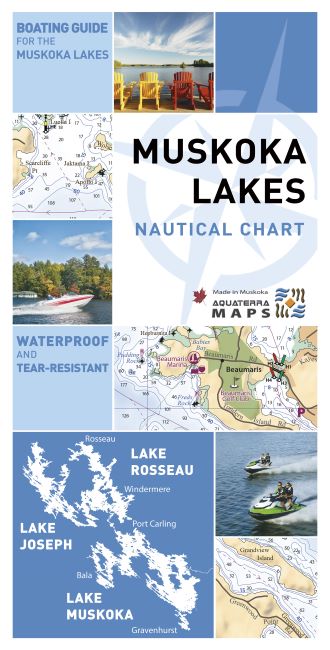
Designed Specifically for the Muskoka Lakes Boater Accurate and Up-To-Date
The folded chart is waterproof and tear-resistant, perfect for your boat or personal watercraft. It includes detailed water depths and buoy locations for Lake Muskoka, Lake Rosseau and Lake Joseph. This chart combines licensed navigational and lake depth data from the Canadian Hydrographic Service with extensive local knowledge provided by local boaters and marina operators. In addition, a complete aerial photography review of all three lakes was completed to maximize accuracy of features and to mark shoals and navigation hazards that were previously uncharted. To accurately represent land based features the chart uses up-to-date shoreline, wetland, road, and land-based elevation data from the Ministry of Natural Resources.
The chart includes easy to understand legends describing the nautical navigation aids. In addition, many route and direction of waterflow lines have been added to aid with safe navigation.
Happy boating!


